
Admittedly, GPS isn’t as great of a feature on a tablet as it is a smartphone thanks to its size and (usually) lack of connectivity. However, there are some enterprising folks out there with iPads capable of using GPS while on the go and those folks need a good GPS app to help them along the way. In this roundup, we’ll take a look at the best iPad GPS apps. If you have an Android device as well, our sister site has a great list of GPS apps for Android too!
Table of Contents
Apple Maps
[Price: Free]
First and foremost is Apple Maps. It’s Apple’s official foray into the world of navigation and it’s been no secret that it had a rocky start. However, the last several iterations fixed a lot of the issues people were having. It’s far from perfect but it’s pre-installed on most Apple devices so you should already have it. Since you can’t uninstall it, you might as well give it a shot, right?
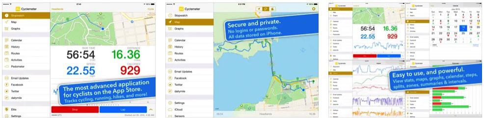
Cyclemeter GPS
[Price: Free / $4.99]
Cyclemeter GPS is actually an application for cyclists and, thus, contains a lot of features specifically geared for them. Some of the cyclist features include workout records, timers, workout analysis, Apple Watch support, and a whole lot more. The app can also be used as a GPS app to plan and discover cycling routes which can be useful for planning workouts or even just biking to work or to the grocery store. It’s free to try with $4.99 being the cost of entry for the “Elite” version.
GasBuddy
[Price: Free]
GasBuddy isn’t a navigation app on the face of it, but it can be extremely helpful when used in tandem with one. GasBuddy shows you gas prices where you are and where you’re going so you can find the cheapest gas available. Using this, you can plan road trips or even just wander around your general area and know that you can find the cheapest gas while doing so. The app is crowd sourced so you can even contribute and list new gas prices as you find them. Everyone going on a road trip or anyone who just drives a lot should have this.
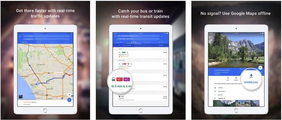
Google Maps
[Price: Free]
Google Maps is practically a household name at this point. Google Maps isn’t quite as powerful on iOS as it is on Android but that shouldn’t stop you from giving it a shot. It contains a ton of map data from 220 countries and territories around the world and includes information on over 100 million locations. This makes it amazingly easy to plan trips and get directions, all while knowing about the places you’ll be running into. There’s even live traffic conditions which can be helpful when planning routes during rush hour.
iExit Interstate Exit Guide
[Price: Free]
This lesser-known navigation app focuses more on freeway driving than anything else. Here’s how it works. You use the iExit search to see where things are off of the highway as you’re driving. Thus, if you’re looking for a Starbucks, iExit will tell you which exit you need to turn off of in order to get it. It’s not necessarily a navigation app in its own right, but it’s great for those unplanned pit stops when you don’t know what you’re getting into.
Get iExit Inserstate Exit Guide
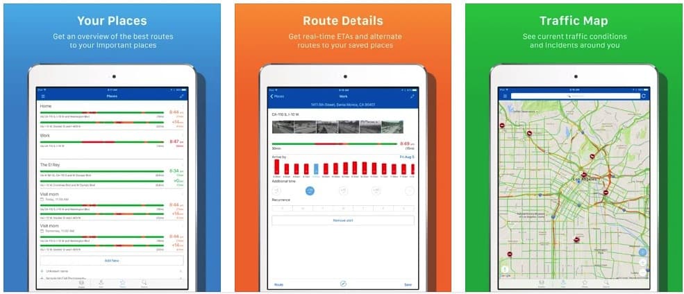
INRIX Traffic Maps
[Price: Free / $9.99]
INRIX is a unique application that focuses a lot more on traffic maps than simply navigation. The point is to let you do things like choose faster routes, avoid traffic jams, and other route planning where traffic could be a factor. You can also get traffic alerts for your routes, see traffic cameras (in select locations), and it even comes with iCloud support. The $9.99 price tag is to get the premium version of the app which adds some additional functionality such as fuel prices and unlimited saved places.
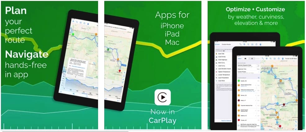
inRoute
[Price: Free / $4.99]
inRoute is a navigation app that tries to make the act of creating routes easier for you with it’s smart route planner. It lets you easily adjust waypoints on the fly in case there’s a problem with traffic and it lets you save those routes for future use. It also contains charts with sunset/sunrise times along with severe weather alerts and more. It’s a unique option, especially since you can plug in the routes on MapQuest’s website or export to GPS devices using GPX files.
Get inRoute from the App Store
Read also: How to Close Apps on the iPad
Maps.Me
[Price: Free]
Maps.Me is a unique option because it specializes in offline maps. This is great if you’re traveling somewhere with limited Internet connection or no connection at all. It includes all of the standard features like planning routes and support for 345 countries and territories so you can use it almost anywhere. It includes a Google Maps-like point-of-interest function that lets you see details on millions of locations all around the world. It’s a great option and totally free to use.
Get Maps.me from the App Store
PlugShare
[Price: Free]
PlugShare is an application designed for those with electric cars. Unlike most cars where you can find a gas station every mile or so, electric cards have fewer places to recharge their batteries and apps like PlugShare can help. It provides a list of public charging points for electric vehicles and includes over 50,000 public stations that you can use. Some locations will even let you pay for your charge through the PlugShare app. If you own an electric car, download this one.
Get PlugShare from the App Store.
Waze
[Price: Free]
Last and certainly not least is Waze. This Google-owned application is a GPS app that also lets you see traffic conditions, police locations, and a lot more information. The app relies on crowd-sourced data so you can even contribute to the Waze experience if you want to. It contains the basics like turn-by-turn navigation (with voice) and maps to plan routes, but you’ll also see up-to-date details on things like traffic and road information so help you plan around issues. It’s a great app and worth a shot.